Building capacity through EDUCATION
“Imagine This” exists to break down transportation concepts in plain language. We talk about how streets actually work, why designs look the way they do, and what’s possible when we plan differently.
The #ImagineThis Series was first presented to the Policy Board on December 16, 2024.

Building capacity through EDUCATION
“Imagine This” exists to break down transportation concepts in plain language. We talk about how streets actually work, why designs look the way they do, and what’s possible when we plan differently.
Soliciting buy in through SOCIALIZATION
We introduce transportation ideas before they show up in a plan. What they’re called. How they function. Where they’re used. So when you hear the term again, it’s familiar—not foreign.
Empowering ADVOCACY
Traffic crashes are not random. We talk about infrastructure treatments that reduce conflict points and save lives. This is about prevention, not reaction—and designing streets that put people first. When you know what tools can work, you can advocate for them.
Nurturing EMPATHY
Data tells one part of the story. People tell the rest. “Imagine This” creates space for speakers to share experiences and for the community to reflect, respond, and be heard.
What if our cities were designed for people, not just cars? What if public transit was seamless, streets were vibrant, and architecture shaped communities for the better? #ImagineThis Speaker series is a thought-provoking speaker series that brings together leading transportation planners, architects, and visionaries to explore what our cities could be if designed with intention, equity, and sustainability in mind. Through engaging presentations and discussions, these experts will challenge the status quo, spark new ideas, and inspire attendees to rethink the way we move and live. Whether you're a professional in the field or simply passionate about the future of urban spaces, Imagine This is your invitation to envision and help create better cities for all.
January 7, 2026
Dr. Appleyard drew on his landmark work to explore how streets can become places where children walk or bike safely, neighbors connect, and climate-friendly transportation thrives.
Attendees learned how smart design, land-use policy, and community engagement intersect to transform our streets from traffic conduits into vibrant public spaces.
September 25, 2025
This event featured Anna Zivarts, disabled activist and author of When Driving Is Not an Option: Steering Away from Car Dependency, who shared her lived experiences navigating a world built for drivers. The discussion explored the barriers and opportunities in creating communities where everyone can thrive, regardless of their ability or choice to drive. The event set the tone for action toward building more inclusive and accessible transportation systems for all.
February 27, 2025
Danish architect and urban planner Jan Gehl kicked off the #ImagineThis Speaker Series with an inspiring talk on creating cities that put people first. He explored the challenges of reducing car dependency in the U.S., strategies for more supportive policy and planning, and opportunities for Hawaiʻi to foster walkable and mixed-use communities through thoughtful design. The event concluded with an engaging Q&A.
Click to view the recording from this presentation.
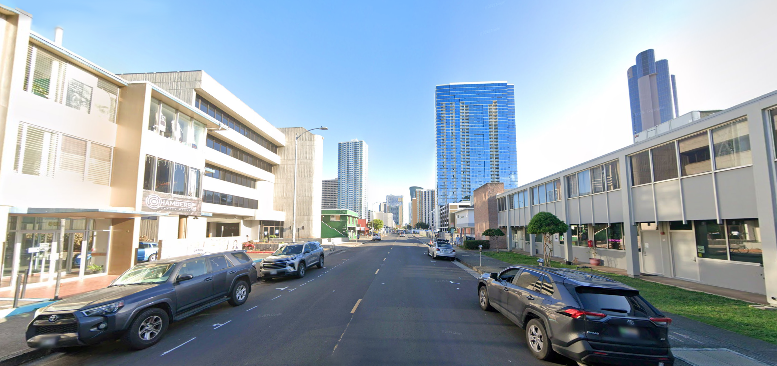
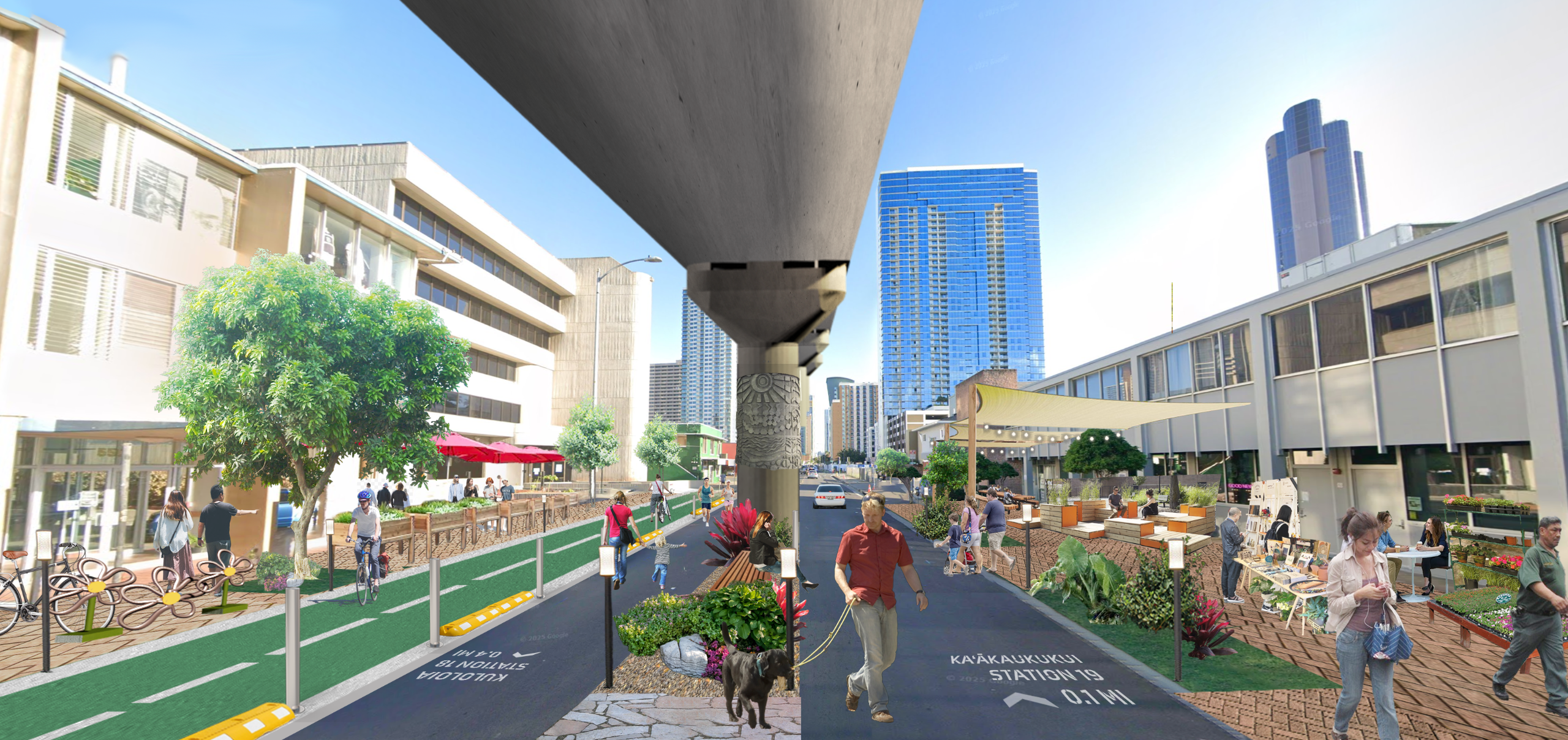
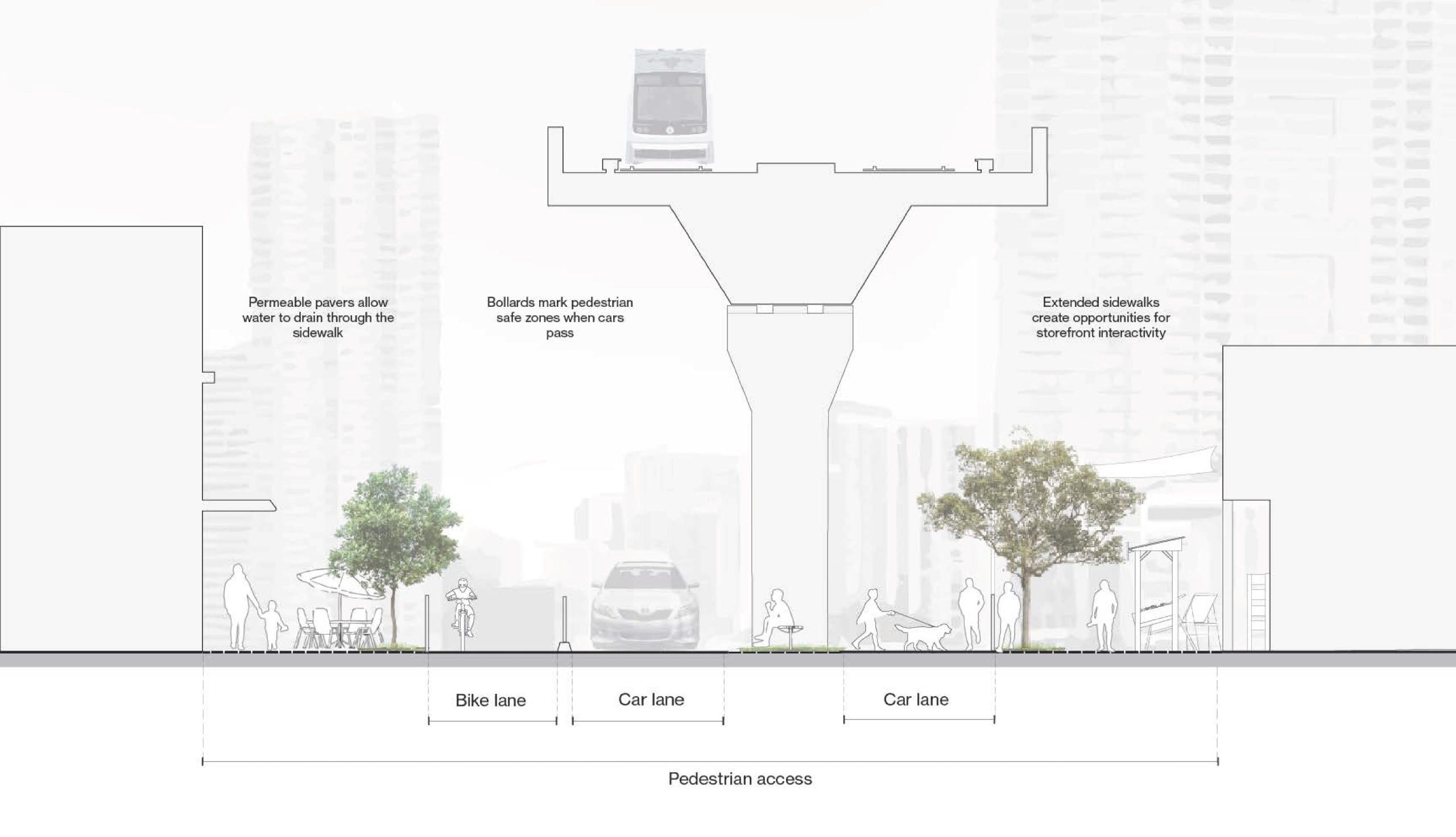
This rendering illustrates a vision for transforming Halekauwila Street in Downtown Honolulu into a shared street, a people-first space where pedestrians, cyclists, and vehicles coexist safely. Curbs are removed, and streetscape features such as bollards, planters, and benches define areas of movement and gathering without limiting pedestrian flow. Vehicle access is limited to essential trips, such as deliveries during designated hours. Textured and contrasting paving materials signal drivers to slow down and yield to pedestrians. With relatively low existing traffic volumes and vacant areas beneath the Skyline rail guideway, Halekauwila Street offers an ideal opportunity to activate underused space, strengthen local economic connections, and foster a vibrant, transit-supportive environment.
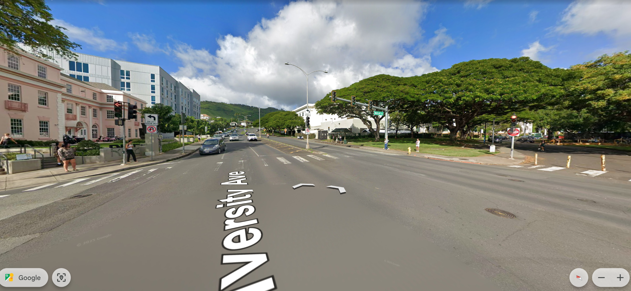
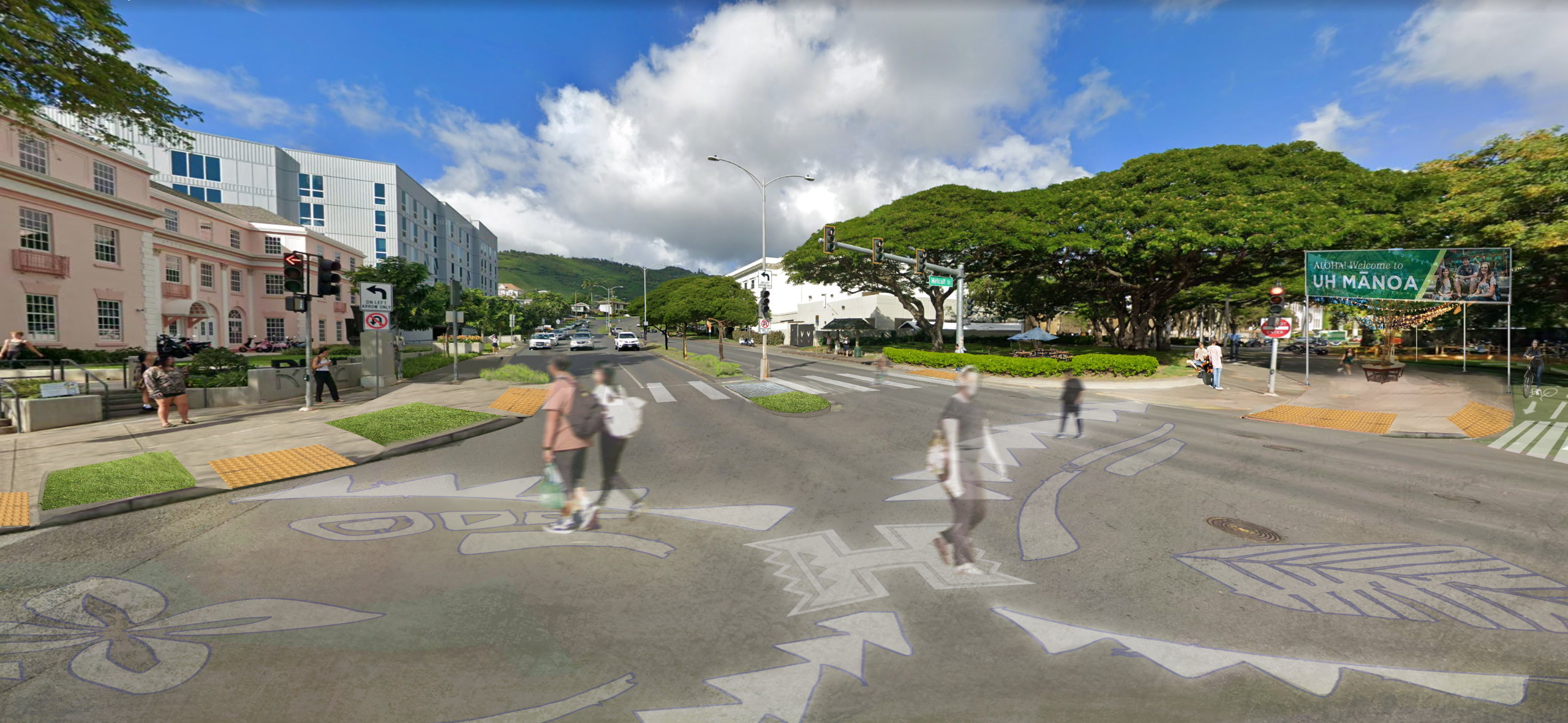
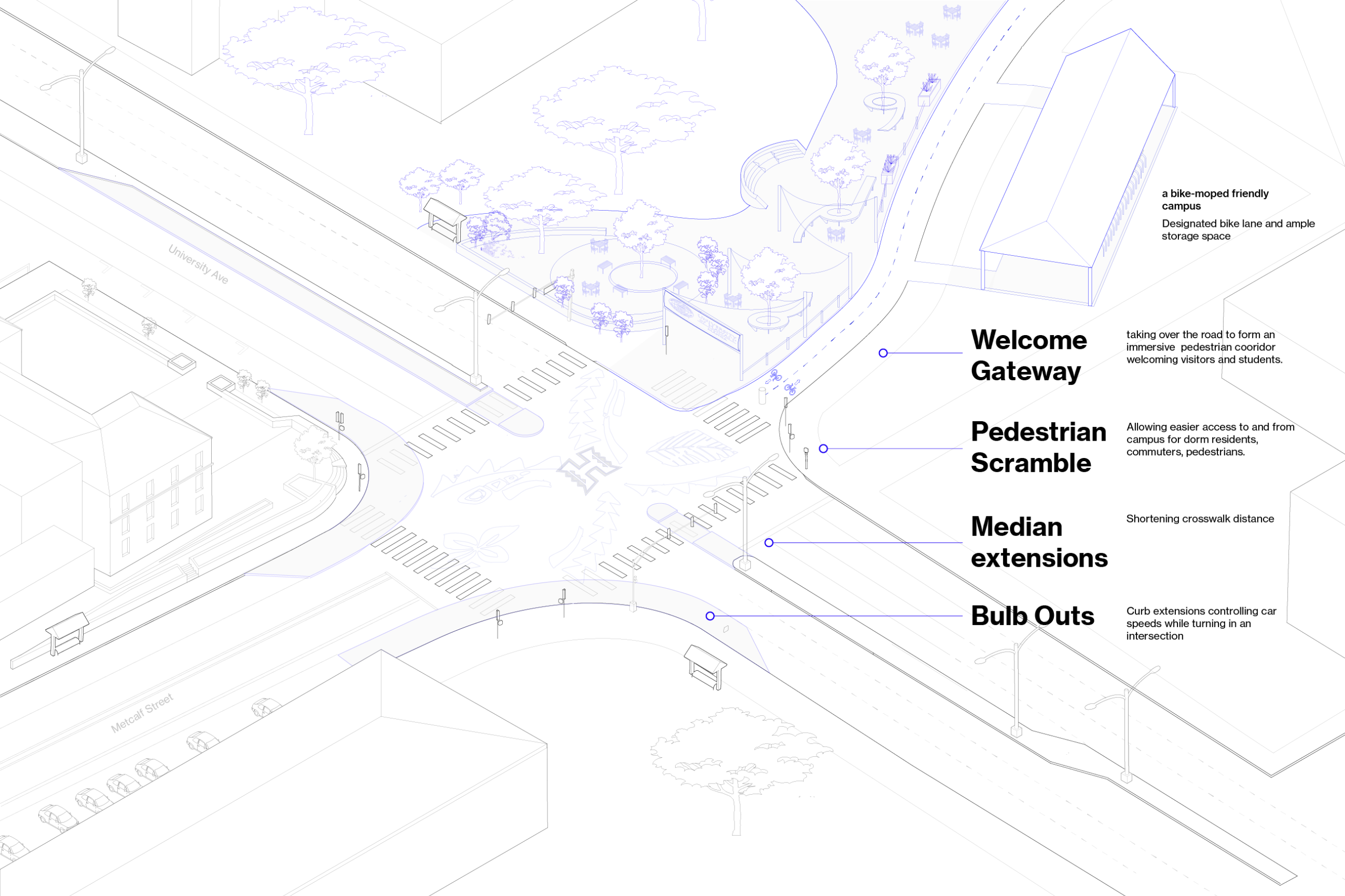
This rendering reimagines the Metcalf Street and University Avenue intersection with a welcoming gateway, pedestrian scramble, and safety enhancements such as median extensions and curb bulb-outs, all designed to improve walkability, visibility, and neighborhood character. Given the University of Hawaiʻi’s bike and moped-friendly environment, the design also introduces a designated two-way bike lane connecting Metcalf Street to the campus, along with ample bicycle parking to further encourage active transportation.
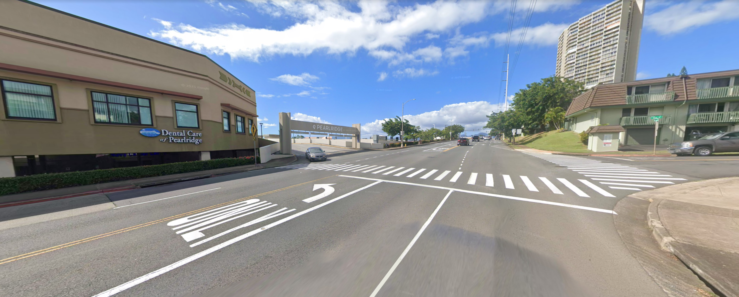
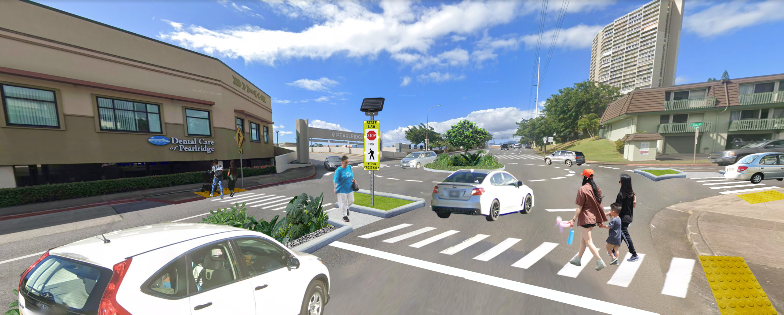
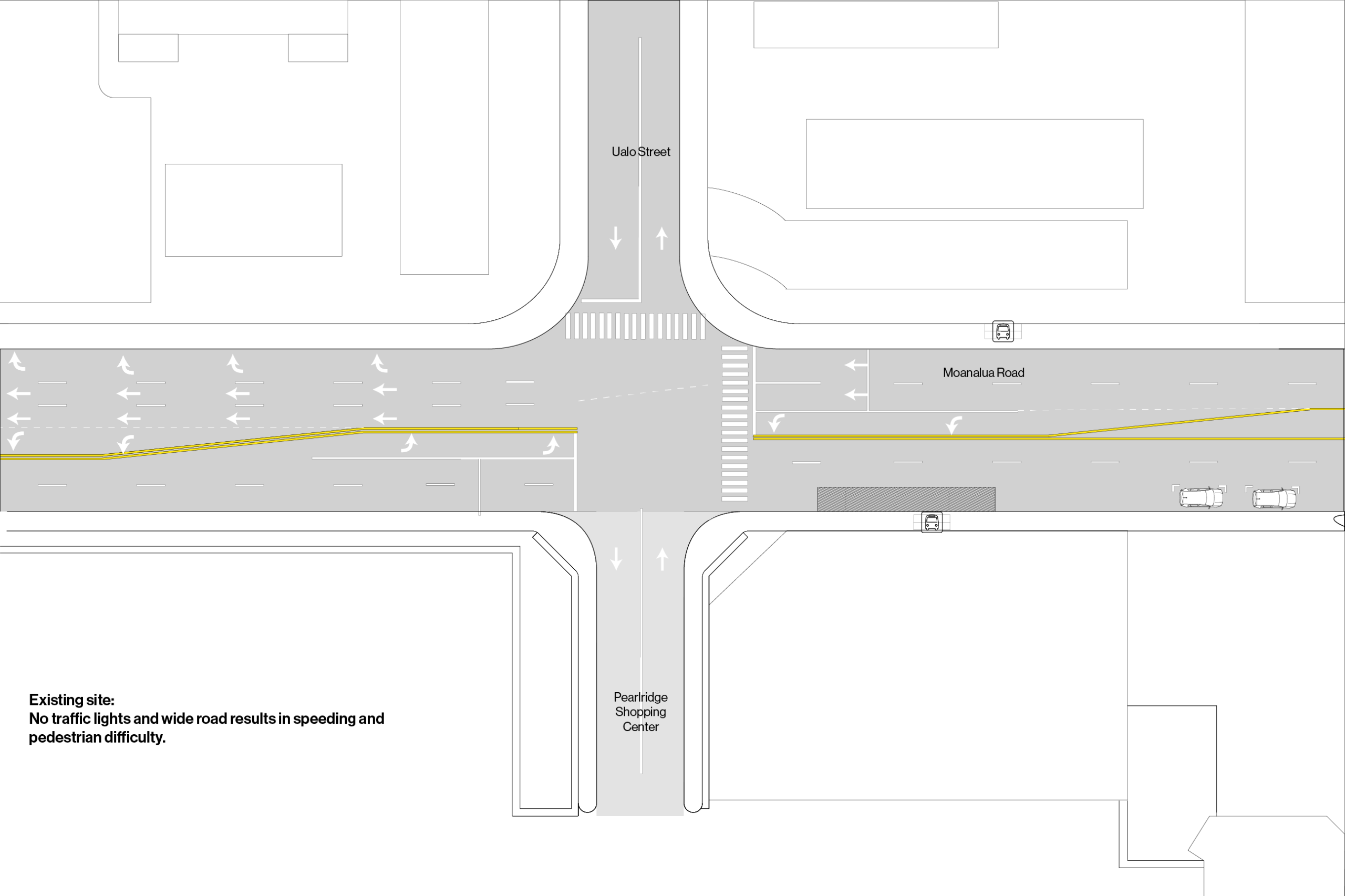
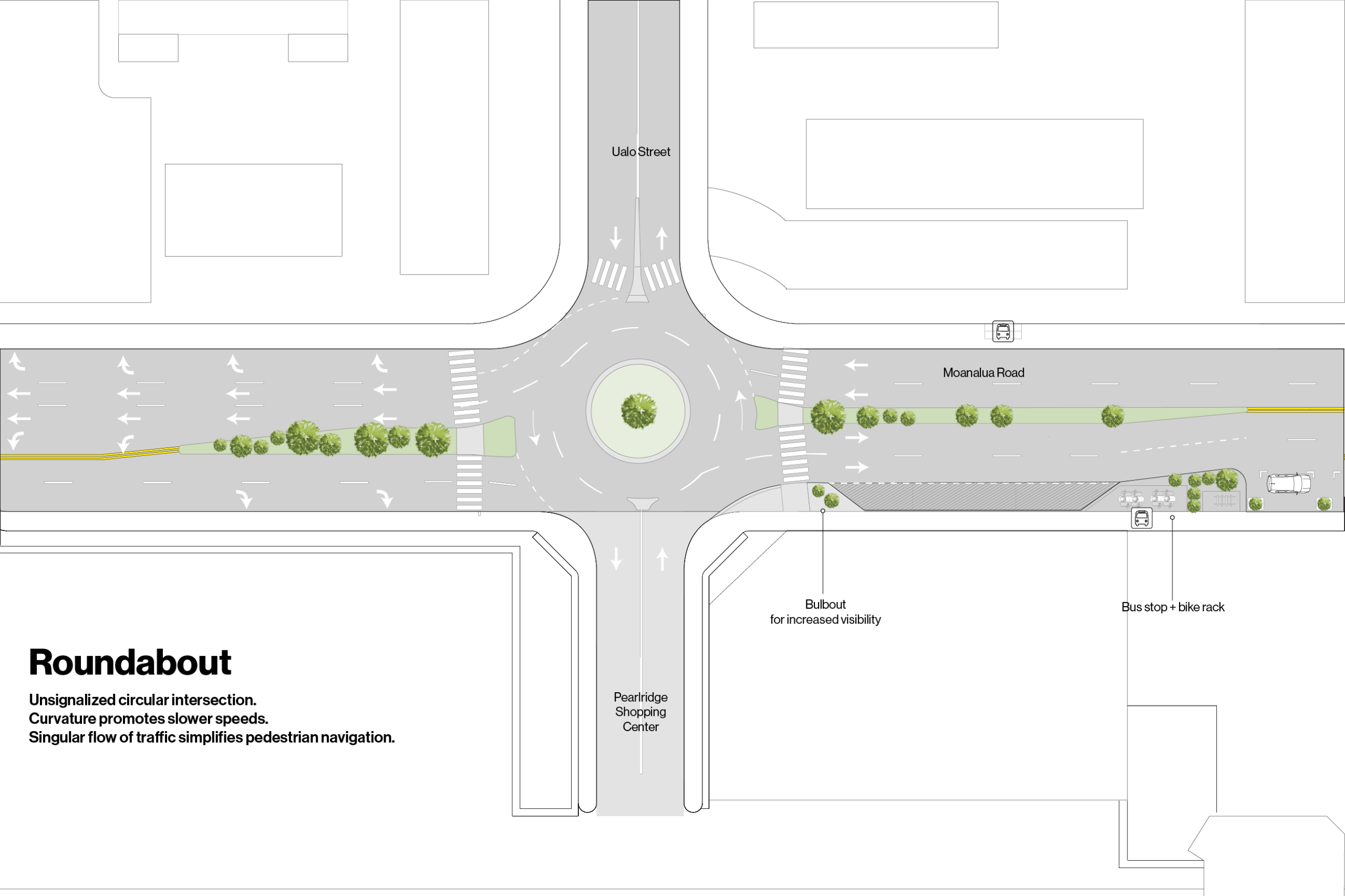
This rendering reimagines the intersection of Moanalua Street and Ualo Street, transforming the wide roadway into a safer, more pedestrian-friendly space with a median refuge and a clearly defined crosswalk. A new roundabout enhances driver awareness and calms traffic, improving safety for those walking to nearby destinations such as Pearlridge Center. Thoughtfully designed landscaping within the median and roundabout further enriches the pedestrian experience and adds visual appeal to the area.
This rendering narrows the road from four lanes to two, and introduces dedicated bike lanes and a tree-lined median. The median not only creates a refuge island for pedestrians at the crosswalk but also provides shaded areas along the roadway. These changes enhance traffic flow, reduce road noise, and increase green space, contributing to a more pleasant and sustainable environment.


This rendering incorporates green features, enhanced landscaping, a raised crosswalk that doubles as a speed bump, wider sidewalks, and bike lane markings. These improvements emphasize a clear prioritization of pedestrians, which is appropriate for the area near the University of Hawaii at Manoa.


This rendering presents a road diet, reducing the four-lane roadway to two lanes with a dedicated center turn lane. This reconfiguration creates space for wider sidewalks, increased green areas, and outdoor dining. Additionally, this design incorporates green features that further buffer pedestrians from traffic and introduces permeable surfaces to manage stormwater, enhancing both the pedestrian experience and the environment.


This rendering enhances Queen Street with dedicated sidewalks, bike lanes, well-equipped bus shelters, green spaces, and improved street lighting. These upgrades align with the transit-oriented development goals of the Kaka'ako neighborhood, with this area being just one block away from the future Civic Center Skyline Station.


This rendering reduces the street to just two traffic lanes and adds a dedicated bike lane, creating a safer environment for both pedestrians and cyclists. The widened sidewalks offer opportunities for increased activation of retail spaces and the addition of sidewalk furniture. Furthermore, this design maintains the roadway's ability to host parades, balancing safety and community events while enhancing the area’s overall vibrancy.


This rendering realigns Sheridan Street to intersect Kapiolani Boulevard at a 90-degree angle, shortening the crosswalk, expanding pedestrian space, and offering opportunities for additional green areas. This design also encourages drivers to navigate the intersection at slower speeds, enhancing safety for pedestrians while preserving the functionality of the roadway for motorists. As a result, the area becomes more pedestrian-friendly without compromising traffic flow.


This rendering introduces a roundabout and dedicated bike lanes to the intersection, while reducing traffic lanes from five in some areas to just two. This reconfiguration creates generous space for pedestrians, improving safety and enhancing the overall flow of traffic.


This rendering introduces dedicated bike lanes, green spaces, and shorter crosswalks at the intersection, while streamlining the overall configuration for all users. By reimagining the space, it reallocates more area to pedestrians, reducing the emphasis on roadways and enhancing the pedestrian experience.

![]()
| Name | Oahu Metropolitan Planning |
|---|---|
| Phone | (808) 587-2015 |
| oahumpo@oahumpo.org | |
| In writing | 707 Richards Street, Suite 200 Honolulu, HI 96813 |
![]()
Public Engagement activities at the OahuMPO are funded in part by the Ulupono Fund at the Hawaii
Community Foundation.


